|
||
|
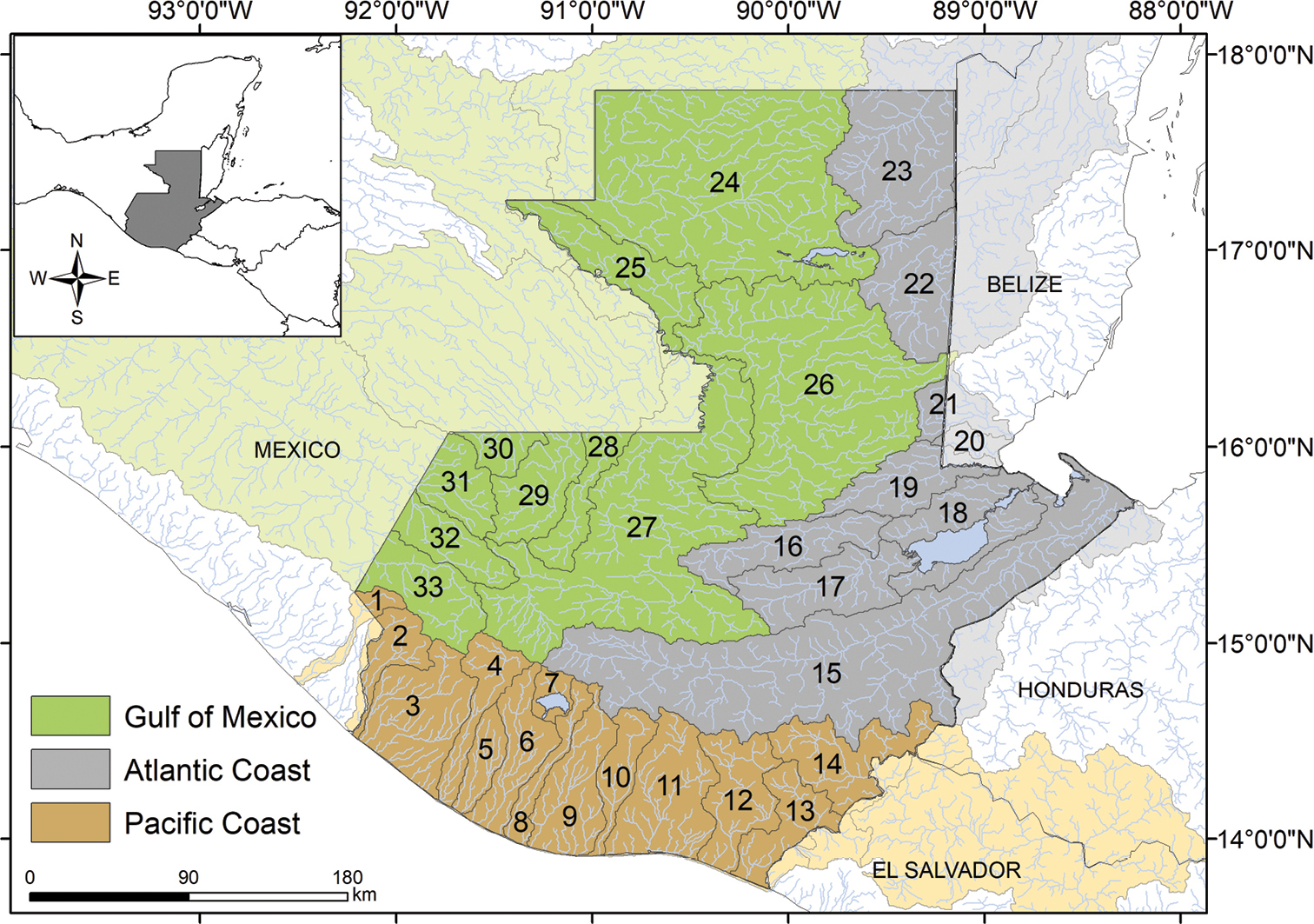
Guatemalan major drainages and river sub-basins, following Suarez (2011). The three major drainages are color shaded. Pacific coast (light brown), Atlantic coast (grey), and Gulf of Mexico (green). The map shows the 33 river sub-basin boundaries, within the political boundaries of Guatemala. River sub-basins shared with neighboring countries are shown in a lighter shade of color. River sub-basins: Río Coatán (1)*, Río Suchiate (2)*, Río Ocosito-Naranjo (3), Río Samalá (4), Río Sis-Icán (5), Río Nahualate (6), Lago de Atitlán (7), Río Madre Vieja (8), Río Coyolate (9), Río Achiguate (10), Río María Linda (11), Río Los Esclavos (12), Río Paz (13)*, Río Lempa (14)*, Río Motagua (15)*, Río Cahabón (16), Río Polochic (17), Lago Izabal-Río Dulce (18), Río Sarstún (19)*, Río Temash (20)*, Río Moho (21)*, Río Mopán-Belice (22)*, Río Hondo (23)*, Río San Pedro-Candelaria (24)*, Río Usumacinta-main channel (25)*, Río La Pasión (26)*, Río Salinas-Chixoy (27)*, Río Xaclbal (28)*, Río Ixcán (29)*, Río Pojom (30)*, Río Nentón (31)*, Río Selegua (32)*, Río Cuilco (33)*. Asterisk denotes sub-basins that are shared with neighboring countries. Major lakes in Guatemala: Lake Atitlán (sub-basin 7), Lake Izabal (sub-basin 18), Lake Petén Itzá (sub-basin 24), Lake Lachuá (sub-basin 27). |