|
||
|
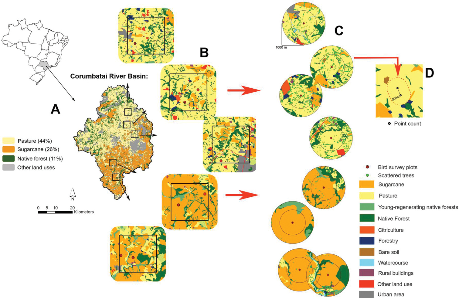
(A) Location of the Corumbatai River Basin in the state of São Paulo, southeastern Brazil. The river basin figure shows the main land use types (Valente and Vettorazzi 2003) and the five focal landscapes 16 km2 (Ferraz et al. 2014) where our bird survey plots were allocated. (B) Focal landscapes are highlighted (squares) with the detailed land use type. Red points indicate the eight bird survey plots. (C) Concentric buffers with 1000 meters and 600 meters radii from each bird survey plot where the landscape structures were collected. (D) Details of bird survey plot and the area used for bird sampling. Each one was composed by two point counts and one line transect. From top to bottom the name of each bird survey plot is: P1, P2B, P2A, P3, SC1C, SC1B, SC2D, SC2E. Names stated with SC means sugarcane matrix and P means pasture matrix. |